The world’s best geospatial AI solution
Unlock the true value of your images with a data engine that's engineered for speed and accuracy. Anticipate and adapt to what your model needs with the most flexible annotations tools.
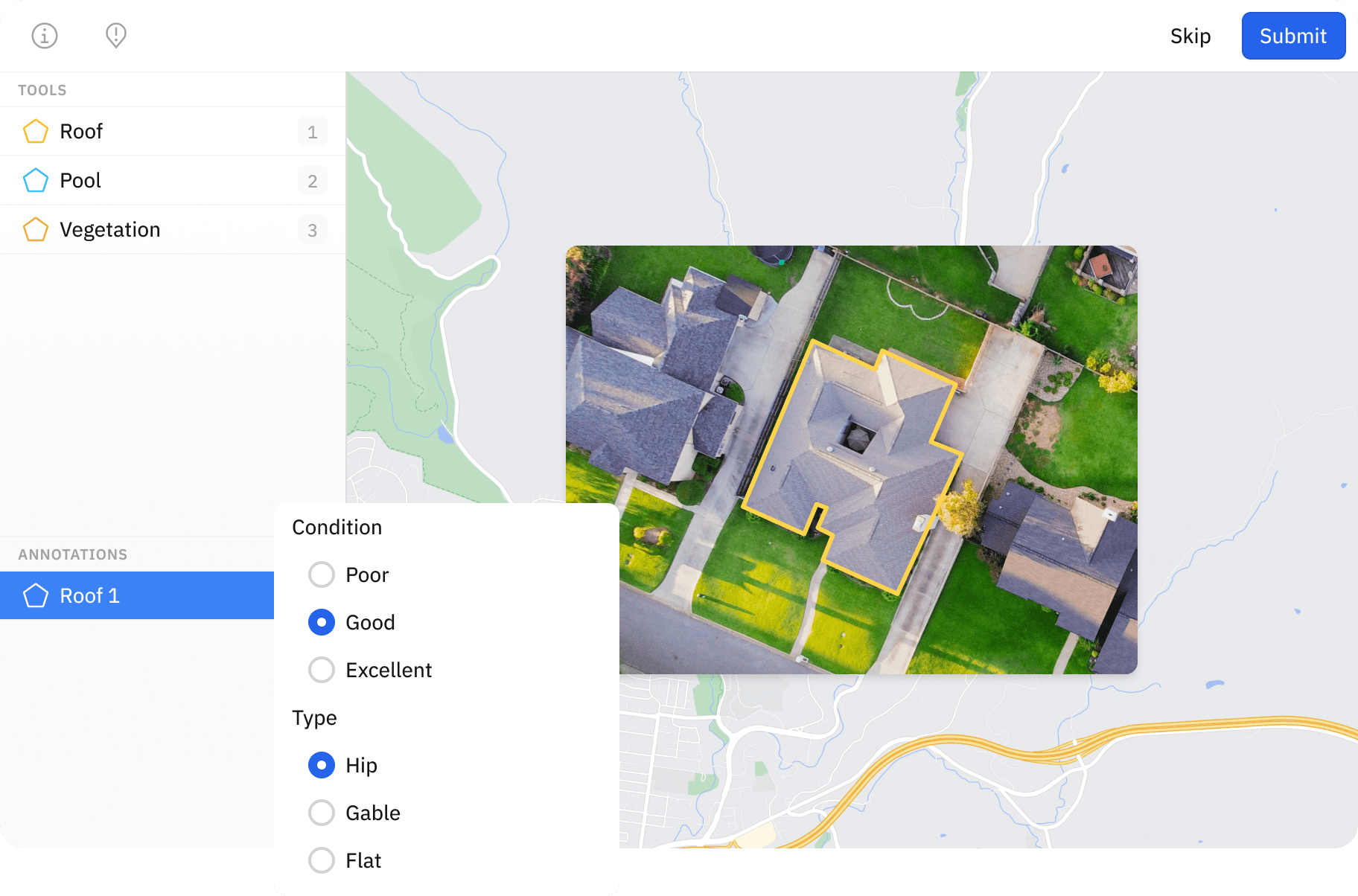

Label directly on geospatial maps
Geospatial AI spans from object detection to change detection and the best AI pipelines are built around geospatial data. Labelbox fully supports all major formats of tiled imagery, with native support for cloud optimized GeoTIFFs (COG), standard GeoTIFFs and National Image Transmission Format (NITF) files. No preprocessing needed; simply provide the image URL and Labelbox handles the rest.
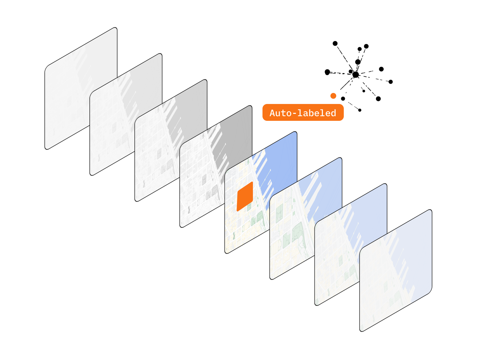
Label faster than ever with automation
Achieve up to 80% in labeling efficiency gains with model-assisted labeling – use models to pre-label data, and let humans focus on corrective actions to generate ground truth so they don’t need to start from scratch.

Create better labels with more context
Bring additional attachments such as text, videos, images, overlays or even custom HTML widgets to aid data labelers to create perfect labels. Labelbox geospatial editor even allows you to import multiple coregistered layers obtained using multi-spectral sensors.

The standard in geospatial data labeling
With a focus on speed, simplicity and use case diversity, this is simply the most powerful geospatial labeling tool on the planet. It's also the most intuitive. Supports bounding boxes, polygons, points, lines, segmentation, relationships, classifications, hierarchical classes and more.
Access the world’s best labeling teams at a click of a button
Access the world’s best data labeling teams to label your data on demand, at scale. The data labeling teams are specialized in geospatial use-cases, in both public or classified environments.
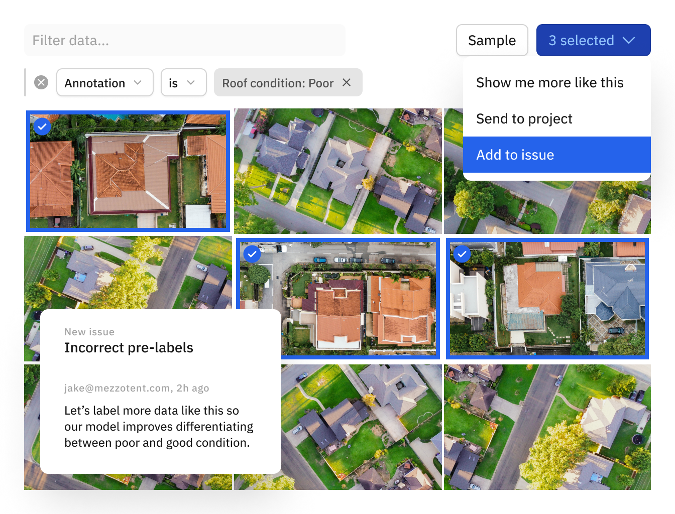
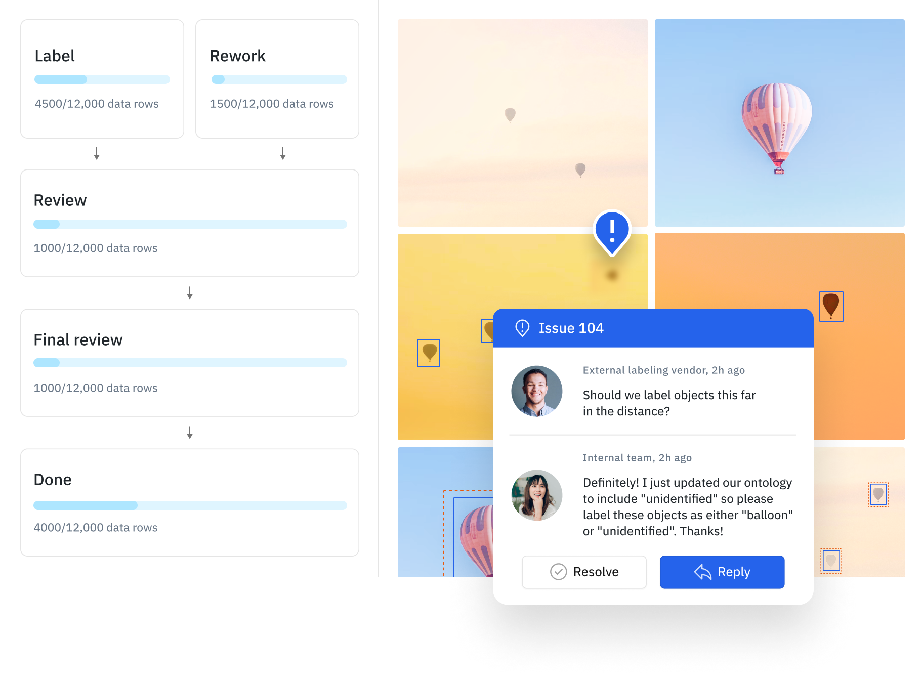
Your toolset to find and fix errors
Easily search for geospatial data using filters such as annotation, metadata, and similarity embeddings to prioritize geospatial to label or create review tasks to fix issues that matter the most.

“There are many geospatial labeling tools out there but the Labelbox backend is the real differentiator. With dynamic queueing, our labelers are never out of work, which was a major upgrade compared to our old internal tools — both from a productivity and speed-to-production point of view.”
Sheetanshu Pandey
CTO
Cape Analytics